


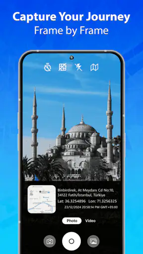
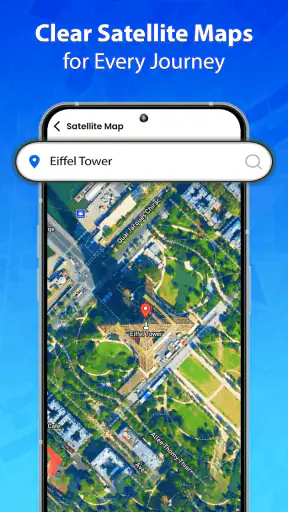
I spent time with GPS Maps Live Navigation as a straightforward driving companion, paying particular attention to how comfortably it works in different situations rather than judging it only by whether it can draw a route. Developed by TarrySoft, this free Maps & Navigation app combines GPS guidance, route finding, traffic information and spoken directions. Its store summary sounds simple, and that is also the main character of the experience: it aims to get you from one place to another without turning the screen into a complicated control panel.
That simplicity can be useful for someone who wants a familiar map view and voice prompts, especially when the phone is mounted in the car. It can also be limiting for people who need highly adjustable visual presentation, detailed public-transport planning or carefully explained accessibility options. My overall impression is that it is best considered a practical secondary navigation tool, or an uncomplicated everyday driver, rather than a complete replacement for every specialist navigation service.
How clearly the map communicates a route
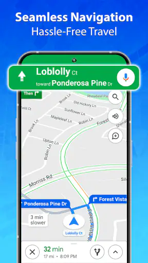
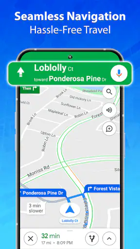
The first thing I noticed is that the app is easiest to understand when I prepare the destination before moving. Searching for a place, checking the proposed route and then putting the phone in a stable position creates a much calmer experience than trying to make decisions while already driving. The route line gives the journey a clear visual structure, while voice directions reduce the need to keep looking down.
For readability, the most important factor is not only the map itself but the distance between the phone and the driver. A small screen placed too far away can make street names and turn details difficult to interpret, regardless of the app. I would use a secure mount, increase the phone’s general text size if needed and test the display while parked. Those adjustments are especially helpful for drivers who find dense map labels tiring or who need more time to recognize a junction.
The spoken guidance is valuable because it allows the route to remain available through sound. I found that this matters most on familiar roads where I do not need constant visual confirmation. It also helps when sunlight, glare or a busy dashboard makes the screen harder to read. Still, voice instructions should be treated as support rather than a substitute for attention. A prompt can tell me to turn, but I still need to judge lane position, signs, cyclists and the behavior of other drivers.
One useful habit is to review the whole route before leaving instead of accepting the first suggestion automatically. I can look for awkward turns, unfamiliar roads or a destination entrance that may not be obvious from the main street. This is a small step, but it reduces the mental load later. It also gives me a chance to decide whether a route looks comfortable for my vehicle and confidence level.
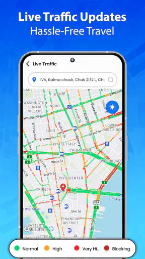
Traffic information adds another layer to the route decision. It is helpful when a delay changes the practical value of one road over another, but live traffic should not be treated as perfect knowledge. Conditions can change quickly, and a supposedly faster alternative may involve more complicated turns. For a driver who prefers predictable instructions, the shortest estimated journey is not always the best journey. I would choose the route I can follow safely and comfortably, even if it is not the quickest option.
Why the interface may suit some users better than others
The uncluttered approach will appeal to people who dislike feature-heavy navigation screens. Someone who mainly wants a destination, a route and spoken prompts can get to the useful part quickly. This is also a reasonable choice for a family member who feels overwhelmed by apps that expose too many planning modes at once.
On the other hand, visual clarity is personal. A person with low vision may need stronger contrast, larger labels or more prominent turn information than the app provides in its standard presentation. I would not assume that the default view works equally well for everyone. Before relying on it for an important trip, I would test it in daylight, at night and in an unfamiliar area, with the phone mounted exactly where it will be used.
There is another readability issue that is easy to overlook: the difference between seeing a route and understanding it. A colorful line on a map may look clear when parked, yet become hard to interpret near a complex interchange. Voice guidance helps, but I still prefer to glance at the map only when stopped or when a passenger can check it. That workflow is safer and more inclusive than expecting every driver to process small visual changes in real time.
Sound, touch and different ways of interacting
GPS Maps Live Navigation naturally favors people who can hear spoken directions and operate a touchscreen. That does not make it unusable for anyone else, but it does affect how much independent information the app communicates through each channel. A driver who is deaf or hard of hearing may need to rely more heavily on the visual route, while a driver with limited vision may depend more on voice prompts. The experience is strongest when both channels are available, so I would test the app with the phone’s normal sound and display settings before starting a demanding journey.
For users with motor difficulties, the preparation stage deserves attention. Entering an address, correcting a search and selecting a route can require several precise touches. I would do those tasks while stationary and, where possible, ask a passenger to handle them. A stable mount also matters: if the phone moves, even a simple tap becomes harder, and repeated attempts can become frustrating.
People who experience hand tremors or reduced fine-motor control may find a voice-first routine more comfortable if their phone and operating-system tools support it. I would not depend on making quick manual changes during a turn. The safer pattern is to set the destination early, start guidance and let the app continue while I concentrate on the road. If the route changes unexpectedly, pulling over is preferable to trying to manage the screen in motion.
For sensory-sensitive users, navigation can be tiring when sound, movement and visual information arrive together. Spoken prompts may be reassuring to one person and distracting to another. I would begin with a short, familiar trip and adjust the phone’s audio level to a comfortable setting. The goal is not maximum volume or constant checking; it is enough information to understand the next decision without creating a new source of stress.
Drivers with hearing loss should consider whether the visual map is sufficiently noticeable in their usual conditions. A quick test with the phone mounted in the car can reveal more than a store description: can I recognize an upcoming turn without depending on audio, and can I do so without staring at the display? If the answer is no, this app may work better with a passenger assisting or alongside another navigation method that offers clearer visual alerts.
A practical routine for everyday trips
My preferred routine is deliberately repetitive. Before leaving, I enter the destination, check the route, confirm that the phone is positioned securely and make sure the spoken guidance can be heard without being intrusive. Once moving, I follow the next instruction rather than repeatedly inspecting the entire map. If I miss a turn, I let the app recalculate instead of attempting a sudden maneuver.
This routine is particularly useful for a short appointment trip. Imagine leaving work for an unfamiliar clinic during a busy afternoon. I would set the destination in the parking area, examine the final approach and note whether the route appears to end at a main entrance or simply near the address. During the drive, traffic information may explain a delay, but I would avoid changing the route repeatedly. Near the destination, I would slow down early because the correct building entrance may require more attention than the last spoken instruction suggests.
That final approach is one of the app’s practical weak spots as a general navigation concept, not necessarily a fault unique to this product. A route can be correct while the real-world arrival remains confusing. Large sites, divided roads and multiple entrances demand judgment. I would keep the destination details available, but I would not assume that reaching the mapped point automatically means I have found the right door or parking area.
When the surrounding situation changes
Navigation access is shaped by context. A route that feels easy in daylight may feel much harder in heavy rain, at night or in an unfamiliar neighborhood. Glare can reduce screen readability, road noise can mask voice prompts and a crowded passenger area can make touch controls difficult to reach. I would test the app in the conditions that matter to me rather than judging it only from a quiet room.
Pedestrians and passengers can use the app differently from drivers. A passenger can inspect the map, help enter a destination or watch for a turn without dividing attention from the road. A pedestrian may appreciate route guidance, but I would be more cautious about assuming that a driving-focused map experience will explain every sidewalk, crossing or entrance in the detail needed by someone with mobility or vision challenges.
For wheelchair users, people using walking aids or anyone who needs step-free access, the route line alone is not enough information. The app can help identify a general destination, but I would verify entrances and the final path through the venue or with the destination itself. A map route does not automatically tell me whether a curb, staircase, narrow passage or inaccessible entrance is waiting at the end.
Travelers with limited data confidence may also wonder whether they can rely on the app in places with weak connectivity. I would not plan an important journey around assumptions about offline behavior. Instead, I would prepare a backup: save the destination details in another form, note major roads and carry enough information to continue safely if the connection or phone becomes unavailable. That is sensible navigation practice even when live traffic is useful.
What still creates friction
The biggest barrier is that the app’s usefulness depends on a phone screen, a functioning GPS signal, audible or visible guidance and a user who can safely prepare the route. If any one of those pieces is unreliable, the experience becomes less forgiving. I would be careful about recommending it as the only navigation option for someone traveling alone in a completely unfamiliar area.
Another limitation is the absence of a clearly demonstrated accessibility-focused layer in the basic experience. I would avoid promising specialized route choices for wheelchair users, detailed visual customization or alternative communication modes unless I had tested those options directly. For many people, standard voice guidance and a map are enough. For others, the difference between “can show a route” and “can support my specific way of traveling” is significant.
There is also a cost consideration. The app is free to install, but it includes in-app purchases ranging from less than a dollar to amounts approaching a hundred dollars per item. That does not automatically make it poor value, but it means I would inspect any purchase screen carefully and decide whether the free experience meets my needs before spending money. Someone looking for a completely cost-free navigation tool should keep that distinction in mind.
At the time of my review, the app is on version 1.4.2 and works on Android devices starting with version 6.0. Its Everyone content rating makes it broadly suitable from a content perspective, but that should not be confused with universal ease of use. A child, older adult or person with a disability may still need help with setup, mounting the phone and understanding safe interaction rules.
Compared with a major platform map app, GPS Maps Live Navigation feels more focused on the basic act of getting directions. The usual alternatives may offer deeper place information, broader travel modes, stronger integration with calendars or more mature accessibility settings. Their extra features can also make them feel crowded. I would choose this app when I want a simpler route-finding experience and already have a reliable way to handle destination details. I would choose a more established all-purpose maps service when I need extensive place reviews, transit planning, walking detail or richer assistance around a complex destination.
The app’s reach is nevertheless notable: it has passed a million installs and holds an average rating of 3.9 from around 2.2 thousand ratings. Those figures suggest that it has found a real audience, while also reminding me not to treat popularity as proof that it will suit every driving style or ability. The developer, TarrySoft, presents a tool with a clear everyday purpose, but the best experience still depends on sensible preparation.
Who should use it and who should look elsewhere
I would recommend trying it if you want free GPS navigation with route guidance, live traffic context and voice directions, and you prefer a less expansive interface than the biggest map platforms. It can be a useful backup on a second phone, a simple option for routine driving or a starting point for someone who does not need a large collection of travel-planning features.
I would be more cautious for a person who needs guaranteed step-free routing, highly specialized visual presentation, detailed pedestrian information or a fully hands-free workflow. I would also look elsewhere if navigation is central to work, emergency response or frequent travel through complicated urban environments. In those cases, a service with more mature accessibility controls and broader route types may justify its extra complexity.
Before committing to it, I would run a short test in a familiar area, then try one moderately unfamiliar trip with a passenger. Check whether the voice is understandable, whether the route line remains readable from the mount and whether the traffic information changes the journey in a useful way. This simple trial answers more practical questions than a quick look at the app’s icon or summary.
My inclusive verdict is cautiously positive. GPS Maps Live Navigation is easiest to recommend as a simple, prepared, voice-assisted driving tool—not as a universal accessibility solution. Its clear purpose, free entry point and combination of map guidance with traffic information make it approachable for many everyday users. I appreciate that I can keep my attention on the road more easily than with a purely visual route.
At the same time, I would not overlook the people for whom ordinary map guidance is only the beginning. Differences in hearing, vision, movement, sensory comfort and destination access can change the whole journey. For me, this app works best when paired with a secure phone setup, a calm pre-trip routine and a backup plan. If those conditions match your needs, it is a sensible app to test; if you require specialized route accessibility or richer travel support, the usual full-featured alternatives are likely the safer choice.


